The agreement was signed on April 4, 2023, by representatives from GFZ, Prof. Susanne Buiter - Executive Scientific Director, and Dr. Stefan Schwartze - Executive Administrative Director, as well as representatives from HUMG, Prof. Tran Thanh Hai - Rector of the University, and Assoc. Prof. Le Duc Tinh – Dean of the Faculty of Geomatics and Land Administration.
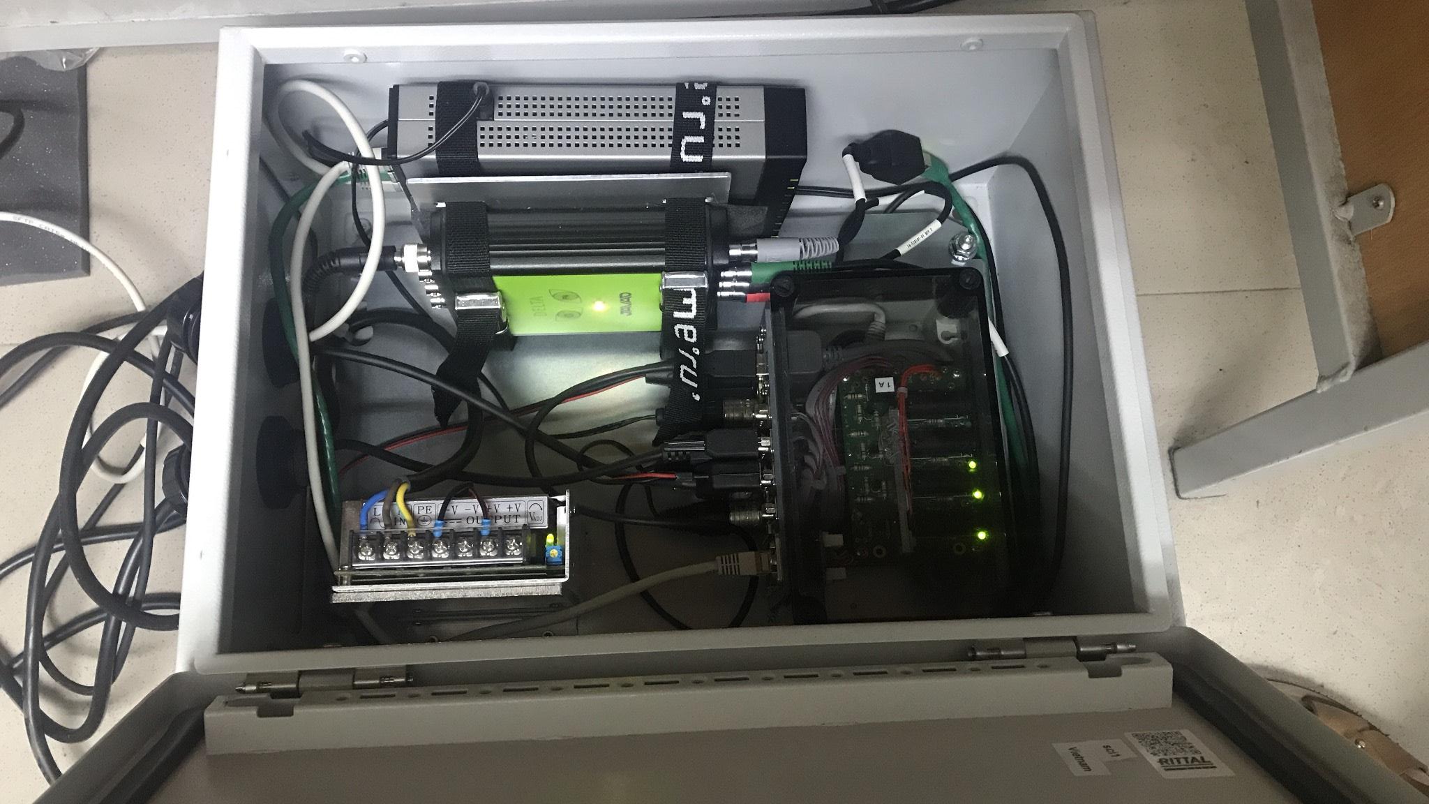
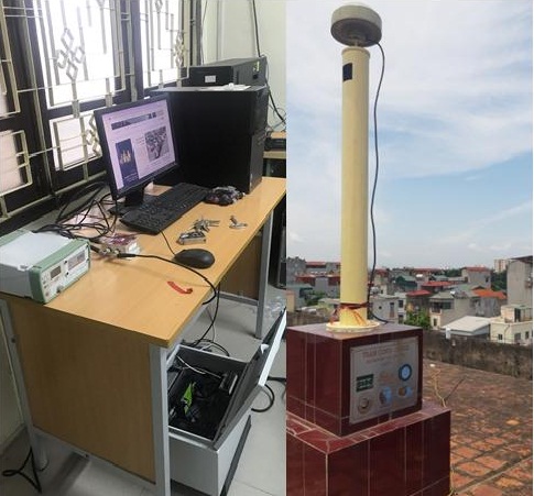
As stated in the aforementioned cooperation agreement, a high-rate (50 Hz) GNSS receiving station has been installed on the roof of Building B at HUMG. The system includes: 01 antenna capable of receiving signals from GPS, GLONASS, and GALILEO global satellite systems, 01 technical box (including a receiver, a tiny PC, a VPN router, etc.), 01 meteorological sensor, and connecting cables. The entire system is networked and can be controlled on-site or remotely from Germany. The main objective of the station is to monitor the ionosphere, specifically ionospheric scintillation in the Hanoi region. With a data recording frequency (interval) of 0.01 seconds (compared to the typical 30 seconds for conventional CORS stations), it can help calculate ionospheric scintillation parameters such as the S4 index, which is among the most complex sources of error in space geodesy techniques. Continuous GNSS data measurements from the station can also be used to calculate Total Electron Content (TEC), the most important parameter of the ionosphere widely used in Space Weather Research. With the attached meteorological sensor, real-time weather information such as temperature, pressure, humidity, wind speed, wind direction, etc., can be provided for the northwest area of Hanoi (Bac Tu Liem District). From this information, the total water vapor content, a fundamental factor in weather forecasting, can be determined. Additionally, the measured data from the station can be combined with data from other CORS stations in the area to detect surface deformation, including crustal movements and ground subsidence or uplift.
This is the result of the work following the visit and collaboration of Professor Harald Schuh, the former president of the International Association of Geodesy (IAG) and Director of Geodesy at GFZ, to HUMG in April 2019. The collaborative project is being implemented under the supervision of Professor Jens Wickert, the Project Director for Atmosphere in Global Change at GFZ. This marks the first collaborative project between HUMG and GFZ and establishes a foundation for both parties to enhance exchange and cooperation in the fields of science and technology in the future, particularly in the research of GNSS technology, atmosphere in the northern region of Vietnam as well as globally.

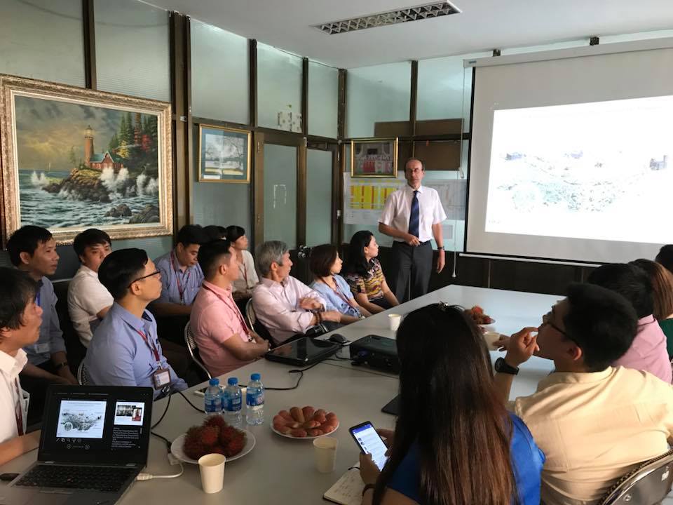
Professor Harald Schuh presented a scientific report at the Faculty of Geomatics and Land Administration in April 2019
According to recent studies, Hanoi is located in a region with strong ionospheric scintillation activity, and it is heavily affected by signal scintillations. As a result, all satellite-based applications, including positioning and remote sensing, are significantly affected. Detecting and studying the occurrence and characteristics of ionospheric scintillation phenomena will help improve the accuracy of positioning, navigation, and other applications of GNSS technology. Building a high-rate GNSS monitoring station at HUMG based on the research strengths in Earth sciences of both GFZ and HUMG will enable Vietnam to participate and integrate into the global network of monitoring stations that GFZ has been establishing.
GFZ, short for GeoForschungsZentrum, is a leading research center for Earth science in Europe. At GFZ, researchers conduct comprehensive studies on the Earth and its surrounding space, including the internal structure of the Earth's core, the Earth's surface, the atmosphere around the Earth, and the planetary systems within the Solar System. The mission of GFZ is to enhance understanding of the Earth's system and the nature of its processes, as well as the changes and impacts of these processes on humans and the global ecosystem. GFZ is known as one of the world's top geodesy research centers. Currently, GFZ operates or collaborates with hundreds of GNSS stations worldwide. Prominent projects and contributions by GFZ include the development of the global geoid model (also known as the Potsdam Potato), satellite gravity projects such as CHAMP, GRACE, GRACE-FO, GOCE, and many others. GFZ is currently focused on developing small-sized, low-cost, low-orbit satellite projects to ensure continuous global geodetic observations and achieve the highest possible accuracy. Additionally, GFZ is researching the integration of space geodetic techniques such as VLBI, LLR/SLR, DORIS, and GNSS, along with the applications of computer science, artificial intelligence, and machine learning to produce increasingly accurate geodetic products. One of their goals is to establish the global reference frame ITRF with a coordinate accuracy of 1 millimeter, which is one of the most important tasks in the advanced global geodesy today.

Scientific equipment is sponsored by GFZ, Germany
After the cooperation agreement between GFZ and HUMG was signed, GFZ provided non-refundable sponsorship in the form of hardware and software equipment to establish a high-rate GNSS receiving station for HUMG. Immediately after receiving the equipment, the Faculty of Geomatics and Land Administration, which was directly assigned to manage it, deployed staff members to study and install the system to connect the station to GFZ's global monitoring network. The faculty's leadership formulated plans and directions for utilizing the station to support training, scientific research, and technology transfer activities of the university. The project was successfully completed after several online discussions between HUMG and GFZ, and it is anticipated that further seminars and conferences will be organized between the two parties to discuss the operation of the station and explore potential future collaborations.

Earth's atmospheric monitoring station was installed at HUMG
The first scientific collaboration project between HUMG and GFZ holds great promise for significant advancements and a broader vision for the future, particularly in the fields of Earth's atmosphere, positioning and navigation, as well as surface displacement monitoring. This collaboration will contribute significantly to enhancing the quality of education, scientific research, and technology transfer at HUMG. Furthermore, this partnership serves as an important foundation for the Faculty of Geomatics and Land Administration to establish and expand its own network of CORS (Continuous Operating Reference Stations) in the future. This will create favorable conditions for research and practical applications in precise geodesy, positioning, and monitoring, with the support and experience exchange from GFZ. The goal is to build a stable and extensive CORS network with reasonable point density to meet the objective of providing accurate data and information on location and surface variations, as well as atmospheric conditions in significant regions throughout Vietnam's territory.