Guests included Prof. Marco Abbiati, Science and Technology Counsellor at the Embassy of Italy; Prof. Venkatesh Raghavan, President of the Association of Geoinformatics Laboratories for Earth Sciences (AGILE); Prof. Maria Brovelli, Vice President of the International Society for Photogrammetry and Remote Sensing; and Dr. Vu Anh Tuan, Deputy Director of the Vietnam National Space Center, alongside scientists and experts from Vietnam and abroad.
Representing HUMG were Assoc. Prof. Dr. Tran Xuan Truong, President; Assoc. Prof. Dr. Nguyen The Vinh, Vice President; Prof. Dr. Tran Thanh Hai, former President; and faculty members, researchers and students.
In his opening remarks, Assoc. Prof. Dr. Nguyen The Vinh noted that advances in Earth observation, remote sensing, GIS and artificial intelligence were creating new opportunities to detect change, forecast trends and support decision-making. He also pointed to continuing challenges in integrating data from multiple sources, ensuring the reliability of AI models and putting research findings into practice. He expressed hope that discussions at GIS-IDEAS 2026 would lead to new collaborations and inspire young scientists to engage more deeply in geoinformatics.
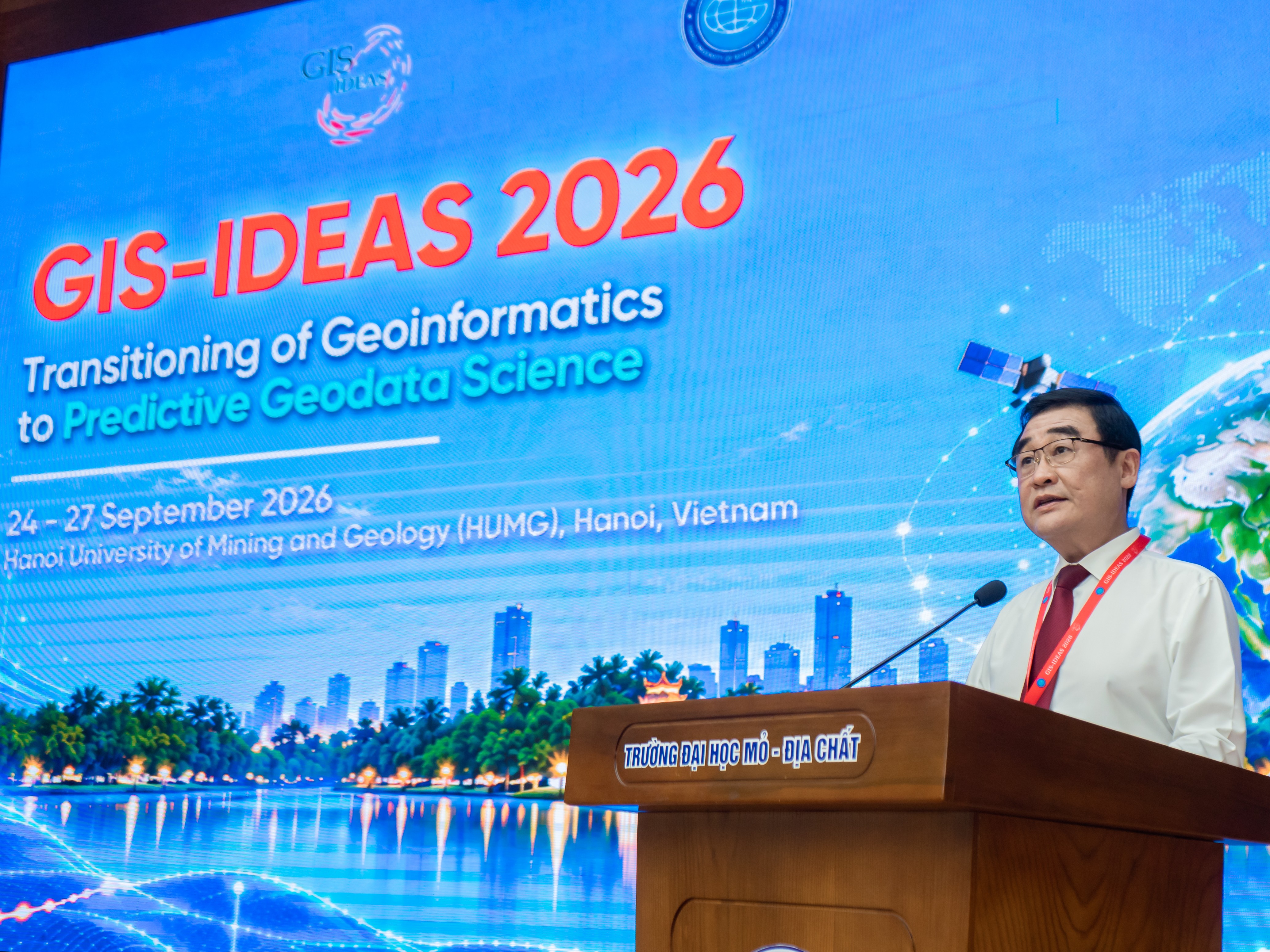
Assoc. Prof. Dr. Nguyen The Vinh, Vice President of HUMG, delivered the opening remarks
Prof. Venkatesh Raghavan, President of AGILE, reflected on the development of GIS-IDEAS since its first conference in 2002 and its roots in the longstanding collaboration between HUMG and Japanese scientists. Over time, the conference has attracted researchers from Thailand, India, Europe and other parts of the world. He encouraged the GIS-IDEAS community to continue sharing knowledge, expanding collaboration and developing geoinformatics solutions that respond to societal needs.

Prof. Venkatesh Raghavan, President of AGILE, delivered remarks at the conference
Speaking on behalf of the Vietnam National Space Center, Dr. Vu Anh Tuan discussed the development of the Vietnam Data Cube platform to integrate Earth observation data and make it available to the research community. He highlighted opportunities to work with HUMG and other GIS-IDEAS partners on algorithm development and product validation, helping turn satellite data into practical solutions for natural resource management, environmental monitoring and disaster risk reduction.
.jpg)
Dr. Vu Anh Tuan, Deputy Director of the Vietnam National Space Center, delivered remarks at the conference
Following the opening ceremony, the plenary session on the morning of 25 September offered four perspectives on advances in geoinformatics and their practical applications. Prof. Marco Abbiati discussed Italy–Asia scientific collaboration in Earth observation in Vietnam. Drawing on a real-world problem, Prof. Dr. Tran Thanh Hai presented an approach that integrates geological, climate, remote sensing and GIS data to assess geological hazards in Lao Cai. Mr. Sanghee Shin discussed geospatial foundation models, while Mr. Sumit Khinvasara focused on translating geoinformatics research into solutions that address practical needs.
The subsequent thematic sessions examined advances in geoinformatics, remote sensing, artificial intelligence and geospatial data science. The GIS-IDEAS 2026 programme featured 111 presentations on analytical and predictive methods to support natural resource management, disaster risk reduction, climate change adaptation and urban development.
.jpg)
Prof. Marco Abbiati presented on Italy–Asia scientific collaboration in Earth observation
.jpg)
Prof. Dr. Tran Thanh Hai presented his research on geological hazard assessment in Lao Cai
.jpg)
Mr. Sanghee Shin presented on geospatial foundation models
.jpg)
Mr. Sumit Khinvasara presented on practical applications of geoinformatics research
Alongside the presentation sessions, the conference included two hands-on workshops on urban land-cover classification and satellite-based land surface temperature mapping using QGIS tools. Following the sessions, delegates were expected to take part in a field visit to Ninh Binh, providing another opportunity to discuss how research can be applied in practice.
Through its presentations and hands-on workshops, GIS-IDEAS 2026 strengthened connections among scientists, universities and research organisations. The findings and methods shared at the conference can support the use of geospatial data in natural resource and environmental management and disaster risk reduction.
Held in the year of HUMG’s 60th anniversary, the conference gave the University an opportunity to build on its research strengths and expand international cooperation. It also enabled young scientists, postgraduate researchers and students to explore emerging research directions. GIS-IDEAS 2026 thus marked another step in bringing together generations of HUMG scholars and the wider scientific community.
.jpg)
Conference delegates posed for a group photograph